
The last time I reached the top of a mountain was the previous year at a mountain in Austria, which coincidentally, is also part of the Alps on the Austrian side. While there was also skiing on top of that mountain, there was little else there. The top of Seceda is pretty much the same, it is also a skiing destination and it is catered primarily to the winter sports crowd. There is one thing which makes Seceda a little different and that is the presence of a panoramic map.
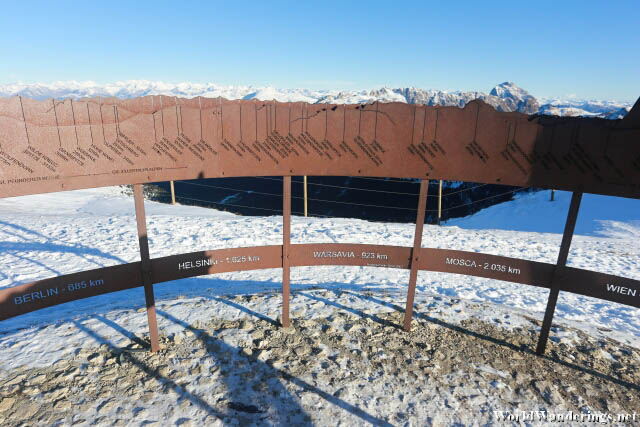
I enjoy looking at these kinds of maps and try to match them to the features in the distance. The panoramic map is a circular one where people can enter from one side. The mountain range is depicted on the map together with their names. Naturally, I don’t know any of the names on the map. However, in addition to the mountains, there are also general directions to various major cities in the world. I guess it an be fascinating to know which direction is a certain city but for me, if I don’t actually see the city, then it might as well not be there. It is just telling me where to look but you won’t be able to see anything anyway, no matter how good the viewing conditions are.
[xmlgm {https://www.worldwanderings.net/kml/SecedaCableCarStation.kmz} zoom=19]


